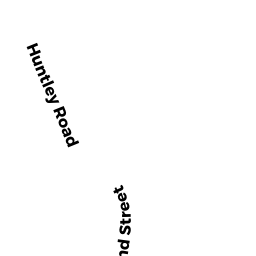
18 HUNTLEY RD
Owner Information
STACK TODD M + JENIFER A
18 HUNTLEY RD
N ATTLEBORO, MA 02760


Property Details
18 HUNTLEY RD is classified as a Single Family Residential (Cape cod).
The primary structure on this property was built in 1962. There are 2,528ft2 of built area within this property. There is 1,075ft2 of residential/living space within this property.
18 HUNTLEY RD is valued at $274,400. The land is valued at $120,200 and the structures are valued at $152,700. There is an additional valuation of $1,500 on this property.
The most recent deed for 18 HUNTLEY RD is recorded at the local registrar in Book 11266, Page 0223. 18 HUNTLEY RD was last sold on Monday, November 25, 2002 for $1.
Assessment data from fiscal year 2022.
Flood Data
According to the FEMA National Flood Hazard Layer, this property does not appear to be in a flood zone. It may also be in an area not yet reviewed. Nonetheless, confirm this information prior to taking any action.
To view the flood hazards around this property, create a FEMA "Firmette" Map of the area around 18 HUNTLEY RD.
Broadband Internet Providers
| Provider | Type | Bandwidth (mbps) | |
|---|---|---|---|
| Viasat Inc | Satellite | 100 | 3 |
| VSAT Systems, LLC. | Satellite | 2 | 1 |
| HughesNet | Satellite | 25 | 3 |
| GCI Communication Corp. | Satellite | 0 | 0 |
| T-Mobile | Fixed Wireless | 25 | 3 |
| Comcast | Cable | 1000 | 35 |
| Verizon New England Inc. | Fiber | 940 | 880 |
| Verizon New England Inc. | DSL | 7 | 0 |
Broadband service provider data from December 2020.
Adjacent Properties
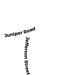
- 16 JUNIPER RD #5
Condo NL MDL-05 owned by GROVES MARIANNE - 30 JUNIPER RD #36
Condo NL MDL-05 owned by LAPERLE RICHARD G + NANCY R - 16 JUNIPER RD #21
Condo NL MDL-05 owned by SADEK ALLAA S - 30 JUNIPER RD #34
Condo NL MDL-05 owned by BICKFORD K MARSHAL - 16 JUNIPER RD #6
Condo NL MDL-05 owned by HEFFERNAM JAMES - 30 JUNIPER RD #42
Condo NL MDL-05 owned by TRANK MARLENE - 30 JUNIPER RD #39
Condo NL MDL-05 owned by KING JANICE R - 16 JUNIPER RD #20
Condo NL MDL-05 owned by LUONGO RANDY S TRS HAWTHORNE - 30 JUNIPER RD #44
Condo NL MDL-05 owned by LEARY EMILY A - 16 JUNIPER RD #2
Condo NL MDL-05 owned by KEMPT LOUISE A - 16 JUNIPER RD #1
Condo NL MDL-05 owned by HARRAR KATIE A - 16 + 30 JUNIPER RD #MAIN
Other, Open Space owned by HAWTHORNE VILLAGE ASSOC - 30 JUNIPER RD #30
Condo NL MDL-05 owned by GALLAGHER RICHARD P - 16 JUNIPER RD #14
Condo NL MDL-05 owned by BREITMAIER JOHN M - 30 JUNIPER RD #A036
Condo NL MDL-05 owned by EMOND BRANDON - 30 JUNIPER RD #31
Condo NL MDL-05 owned by TANIOUS MARY + SAMI - 16 JUNIPER RD #18
Condo NL MDL-05 owned by PREEMINENT PROPERTIES LLC - 16 JUNIPER RD #A015
Condo NL MDL-05 owned by OSULLIVAN WILLIAM + CAROL - 16 JUNIPER RD #11
Condo NL MDL-05 owned by WRIGHT TAMMY - 16 JUNIPER RD #9
Condo NL MDL-05 owned by CRAIG MATTHEW B - 16 JUNIPER RD #3
Condo NL MDL-05 owned by DIGIAMPIETRO ALFRED J - 30 JUNIPER RD #46
Condo NL MDL-05 owned by LETOURNEAU AMY - 16 JUNIPER RD #A014
Condo NL MDL-05 owned by WIGMORE CHARLES - 30 JUNIPER RD #A037
Condo NL MDL-05 owned by TRABOULSSI JOSEPHA A - 30 JUNIPER RD #25
Condo NL MDL-05 owned by DARAZI ELIA - 16 JUNIPER RD #23
Condo NL MDL-05 owned by CRUZ ROSEMARIE + PARMEGGIANI NICOLE TRS - 30 JUNIPER RD #48
Condo NL MDL-05 owned by CATHOLDI DAVID P + GIROUARD ANGELA R - 16 JUNIPER RD #16
Condo NL MDL-05 owned by SOUSA JOSE C - 30 JUNIPER RD #49
Condo NL MDL-05 owned by LABONTE BROOKE R - 16 JUNIPER RD #17
Condo NL MDL-05 owned by ERICKSON BARBARA E + ROBERT J - 30 JUNIPER RD #50
Condo NL MDL-05 owned by MCCARTHY LOIS TRS JANICE M MONBOUQUETTE - 30 JUNIPER RD #40
Condo NL MDL-05 owned by MCNULTY MARY - 30 JUNIPER RD #35
Condo NL MDL-05 owned by HOWE PHILLIP J - 30 JUNIPER RD #26
Condo NL MDL-05 owned by ZIKRY ADEL - 30 JUNIPER RD #51
Condo NL MDL-05 owned by MCCORMICK KEVIN M - 30 JUNIPER RD #37
Condo NL MDL-05 owned by LON LARRY - 16 JUNIPER RD #8
Condo NL MDL-05 owned by OBRIEN JOHN T + KARAGEORGE KARISSA M - 30 JUNIPER RD #24
Condo NL MDL-05 owned by KERWIN DAVID - 30 JUNIPER RD #43
Condo NL MDL-05 owned by MILLER ALLAN RICHARD + LAURIE ANN - 30 JUNIPER RD #28
Condo NL MDL-05 owned by LITTLE LINDA - 30 JUNIPER RD #47
Condo NL MDL-05 owned by PATTEN BARBARA - 30 JUNIPER RD #45
Condo NL MDL-05 owned by SHRIVASTAVA ANUNBHA - 16 JUNIPER RD #22
Condo NL MDL-05 owned by MCDERMOTT MOSES M - 30 JUNIPER RD #32
Condo NL MDL-05 owned by RICHARDS ROBERT - 30 JUNIPER RD #27
Condo NL MDL-05 owned by SIMPSON NATASHA - 16 JUNIPER RD #7
Condo NL MDL-05 owned by PROVOST THOMAS R + LINDA T - 30 JUNIPER RD #29
Condo NL MDL-05 owned by ABREAU JAMES J - 16 JUNIPER RD #15
Condo NL MDL-05 owned by CLEARY KAREN M - 16 JUNIPER RD #10
Condo NL MDL-05 owned by BEAUCHAINE JOHN + VANESSA - 30 JUNIPER RD #41
Condo NL MDL-05 owned by LIANG KUO-YUNG - 16 JUNIPER RD #19
Condo NL MDL-05 owned by GOWEN DAVID M TR - 16 JUNIPER RD #4
Condo NL MDL-05 owned by HERRING HOLLY L - 16 JUNIPER RD #12
Condo NL MDL-05 owned by RAMIREZ AGUSTIN M - 30 JUNIPER RD #33
Condo NL MDL-05 owned by MCCORMICK KEVIN - 30 JUNIPER RD #38
Condo NL MDL-05 owned by BLANCHARD ROY - 338 RESERVOIR ST
Single Family Residential owned by CARISTI DAVID C + JOANNA M - 26 HUNTLEY RD
Two-Family Residential owned by BRADLEY SANDRA J